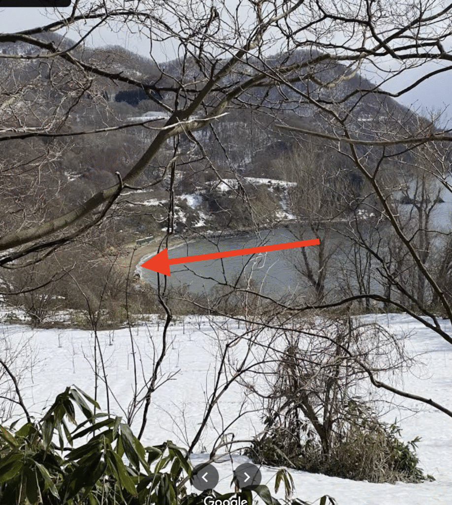
Very little publicity was made about multiple pieces of debris from KAL-007 discovered washed ashore in southern Hokkaido and northern Honshu. One piece was found on Chas Beach near Toyoura in Hokkaido on Sept 16th at 9:10am by a civil engineer. He took the find to the Hokkaido prefecture police. This in turn was reported in the Hokkaido Shimbun on Sept 17th, 1983.
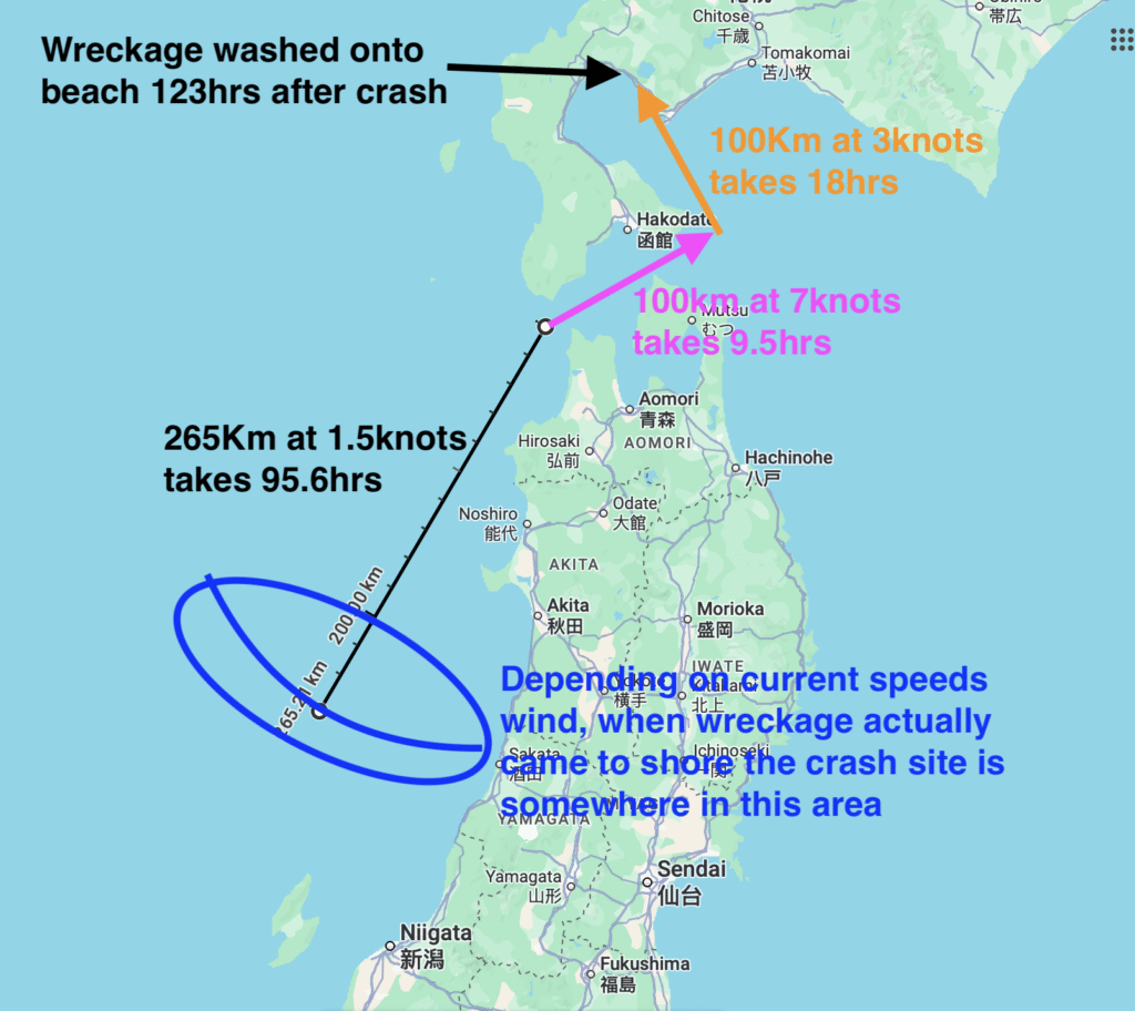
This was important as the debris could not have come from Moneron Island near Sakhalin due to the nature of currents in the area. This fact was not lost on the Japanese and the papers are full of the strong northerly flowing currents. For a crash site near Sakhalin the debris should travel north, not south so it was not possible for the crash site to be around Sakhalin but much further south.
The two currents that dominate in Japan are the Tsushima current which always flows north at around 1-2 knots. This splits to form the Tsugaru current which travels between Hokkaido and Honshu at an incredible 7-8 knots from west to east.
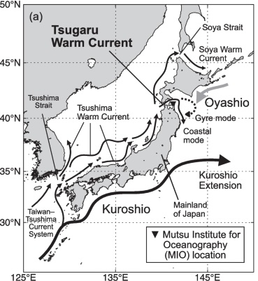
In addition to this strong current flow a large low pressure system (Typhoon Ellen) caused strong SW winds (i.e. blowing towards the NE in line with the currents) and 2-4m swells on Sept 4-5. After the low pressure system passed the winds turned NE and it was this wind that caused some of the debris flowing in the Tushima current onto the northern beaches of Hokkaido.
An extremely rough back of the envelope calculation ignoring wind shows this piece of debris must have come from a location just north of Sado Island.
Debris also washed ashore around Sai on the main Island of Honshu and first discovered on Sept 14th which also could not have arrived from Sakhalin.
Update: Sept 28, 2025 A much more detailed debris drift analysis using historical currents, wind and wave data has been done here https://kal007search.com/debris-drift/
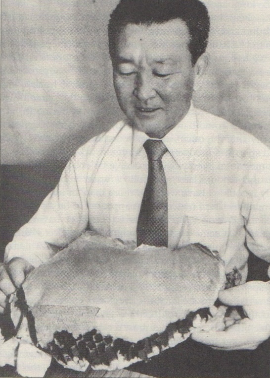
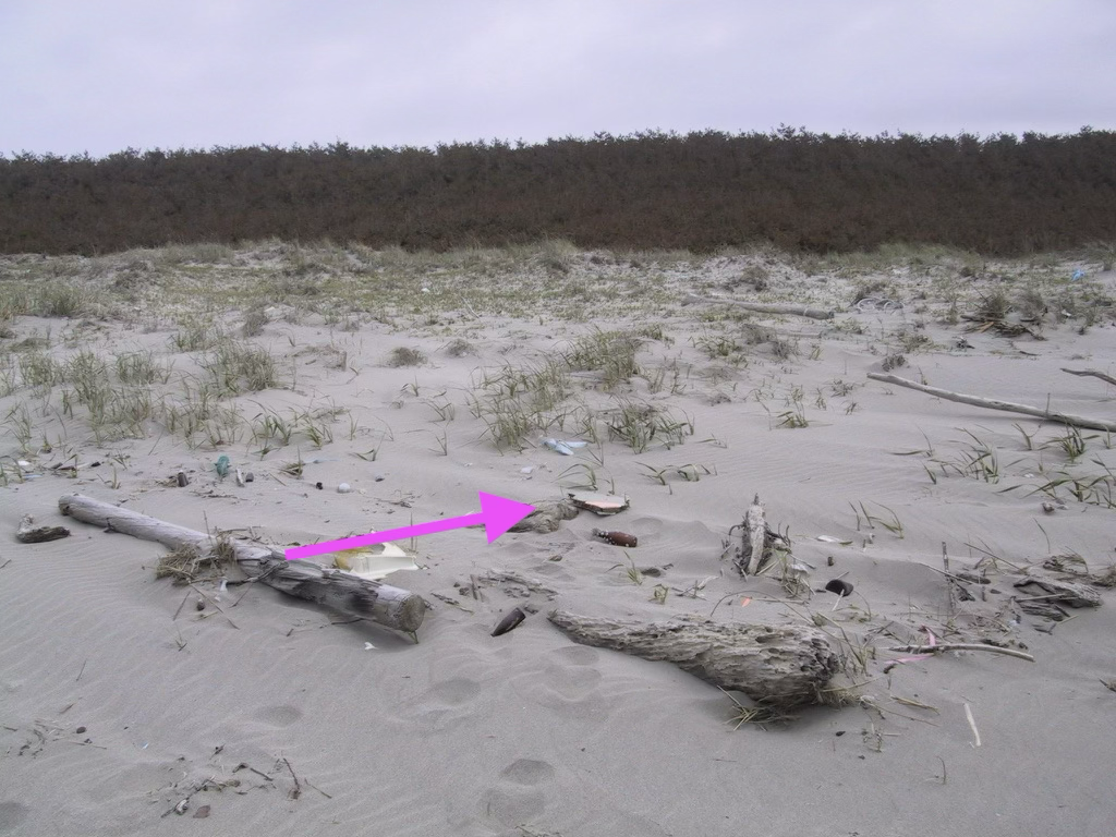
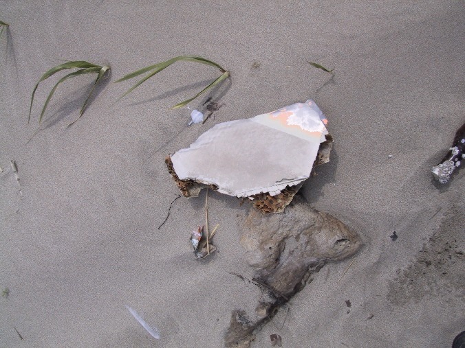
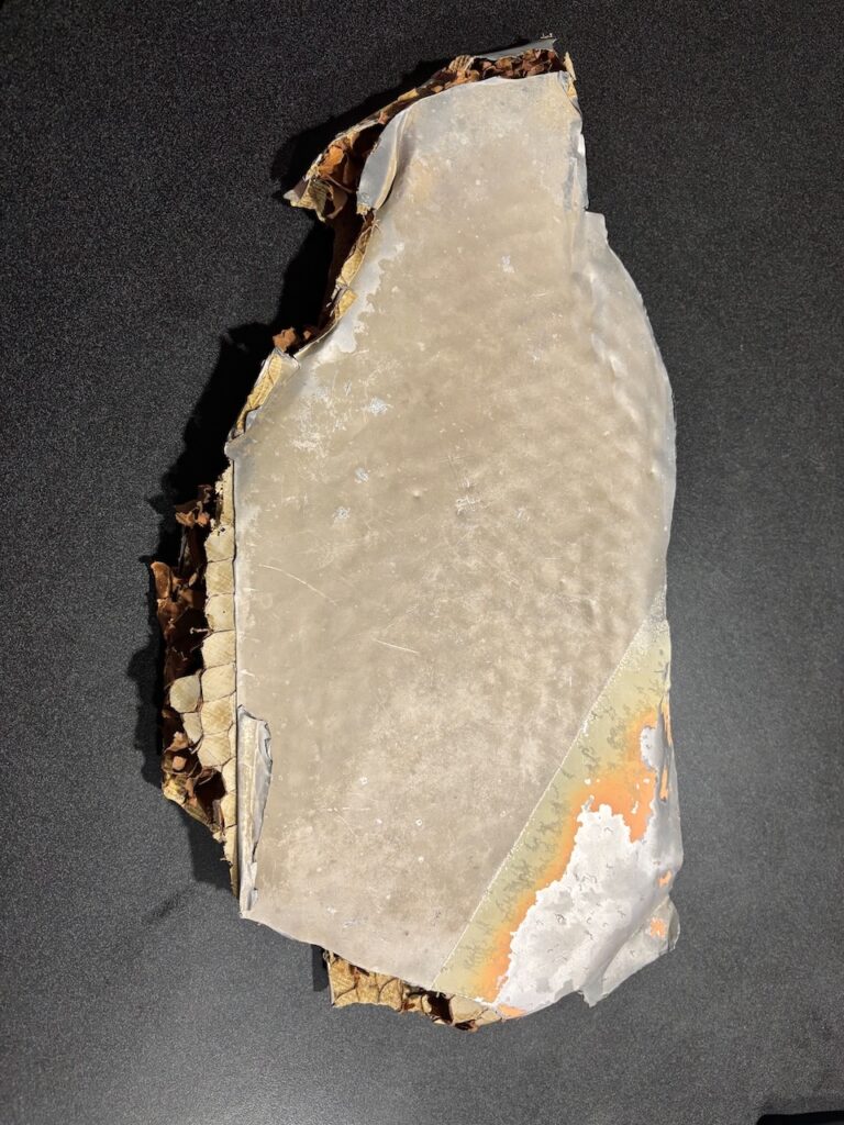
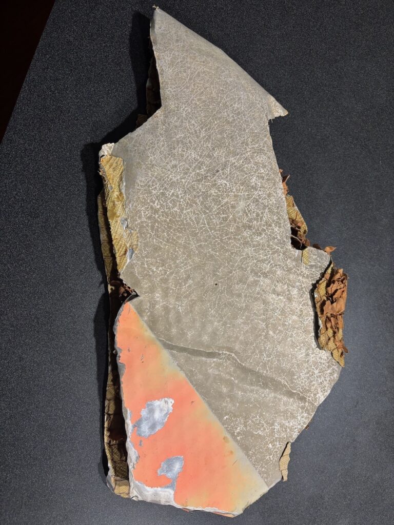
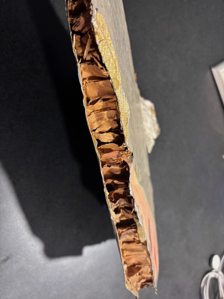
Michel Brun found debris much later in 1989 and 1991 on many beaches as far south as Murakami. Inspired by Brun I collected the same honeycomb debris in 2001 approximately in the area of Shimohama (south of Akita). Click to expand.
For an interactive heat map of debris found please visit https://jim-flex.github.io/KAL007/heatmap11.html
For specific locations and more photos please refer to following table.
| Date found | Lattitude | Longitude | #pieces | Comment/link |
|---|---|---|---|---|
| 6/9/1983 | 42.575028 | 140.7207 | 1 | Chas Beach |
| 9/9/1983 | 46.348751 | 141.31640 | 4 | Moneron |
| 9/9/1983 | 43.925879 | 144.56101 | 2 | N. Hokkaido |
| 9/9/1983 | 44.101234 | 144.21767 | 2 | N. Hokkaido |
| 9/9/1983 | 44.234799 | 143.60889 | 2 | N. Hokkaido |
| 9/9/1983 | 44.421378 | 143.23555 | 2 | N. Hokkaido |
| 9/9/1983 | 44.696778 | 142.82320 | 2 | N. Hokkaido |
| 9/9/1983 | 44.885053 | 142.62865 | 2 | N. Hokkaido |
| 10/9/1983 | 46.091363 | 141.16726 | 2 | Moneron |
| 10/9/1983 | 45.356208 | 142.13745 | 3 | Tail fin Japan |
| 10/9/1983 | 46.665628 | 141.85700 | 1 | Tail fin Russia |
| 11/9/1983 | 45.365623 | 142.11816 | 3 | Papercup |
| 11/9/1983 | 44.485741 | 143.12408 | 3 | Handbag |
| 13/9/1983 | 41.410260 | 140.83647 | 1 | Sai |
| 17/9/1983 | 41.339251 | 140.81684 | 14 | Sai |
| 17/9/1983 | 41.453725 | 140.87910 | 9 | Sai |
| 20/9/1983 | 41.355907 | 140.82306 | 6 | Sai |
| 16/11/1989 | 41.311683 | 140.80473 | 2 | Brun P57 |
| 21/11/1989 | 42.066025 | 139.43866 | 1 | Brun P59 |
| 22/11/1989 | 42.100582 | 139.42551 | 10 | Brun P60 |
| 23/11/1989 | 42.071533 | 139.46693 | 4 | Brun P61 |
| 27/11/1989 | 42.366582 | 140.29141 | 2 | Brun P105 |
| 5/8/1990 | 39.598709 | 140.05998 | 7 | Brun P96 |
| 6/8/1990 | 39.203687 | 139.89291 | 3 | Brun P99 |
| 7/8/1990 | 39.231498 | 139.90626 | 9 | Brun P99 |
| 8/8/1990 | 39.195333 | 139.90551 | 1 | Brun P99 |
| 9/8/1990 | 39.040002 | 139.86335 | 2 | Brun P100 |
| 10/8/1990 | 38.540207 | 139.54815 | 3 | Brun P101 |
| 11/8/1990 | 38.231971 | 139.44789 | 1 | Brun P101 |
| 9/9/2001 | 39.477893 | 140.04027 | 1 | Shown above |
| 9/10/2001 | 39.454752 | 140.03431 | 1 | Thompson |
| 9/11/2001 | 39.447933 | 140.03279 | 1 | Thompson |
| 4/7/2025 | 38.822992 | 139.77383 | 1 | Thompson |
| 7/7/2025 | 39.572150 | 140.05709 | 1 | Thompson |