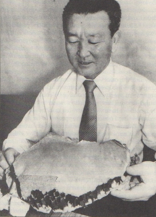
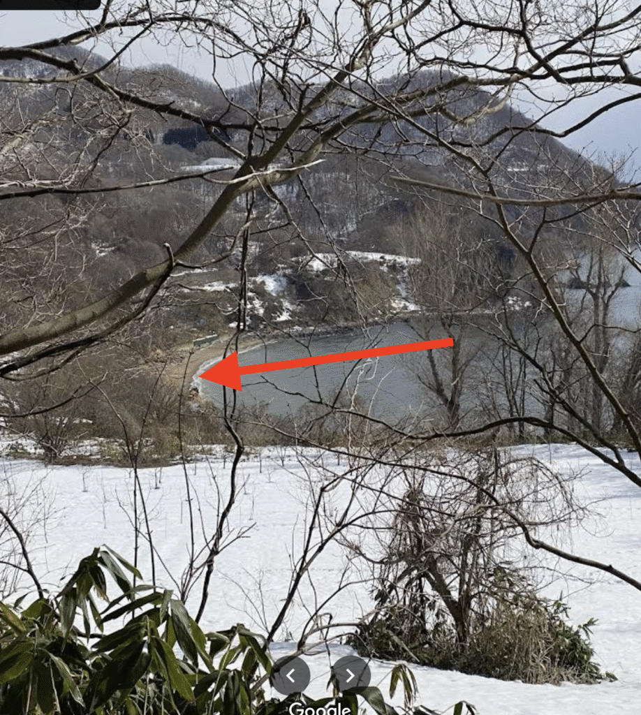
The first piece of debris coming from KAL-007 was collected on 6th Sept, 1983 on Chasu beach, near Toyoura by a Civil engineer. He took the find to Hokkaido prefecture police. Only after debris matching this piece arrived on northern Hokkaido beaches did police make the connection and this was reported in the Hokkaido Shimbun newspaper on 17th Sept.
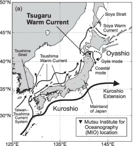
There are two dominant currents in this area of Japan. The north flowing Tsushima current and the Tsugaru current. The Tsushima current flows at 1-2knots where the Tsugaru current travels at an amazing 7knots.
Since we know the time of incident, the time the debris was collected and the speed of the currents for the majority of the journey we can calculate roughly where the impact site must have been.
The current in the Tsugaru straight flows at approximately 7knots and the wreckage had to have travelled about 124km in this fast flowing stream. This would take around 9.5hrs.
It would have travelled slower once it exited the Tsugaru current towards where it was found on the beach near Toyoura. The distance travelled was 100km. If we estimate the current was an average of 3 knots it took 18hrs to travel this distance.
Since the wreckage was found 122hrs after the official crash time it was therefore flowing in the northerly Tsushima current at 1.5knots for 94.5hrs. However, the crash must have been much further south for the debris to arrive where it did. The plane must have thus flown approximately one more hr so the debris travelled for a total of 123hrs or 95.5hrs in the Tsushima current. It would therefore travel approximately 265Km in this current.
Depending on when the wreckage actually arrived on the beach vs when it was found (earlier) and the variability of current speeds, it means the actual crash site must have been in the blue circle.
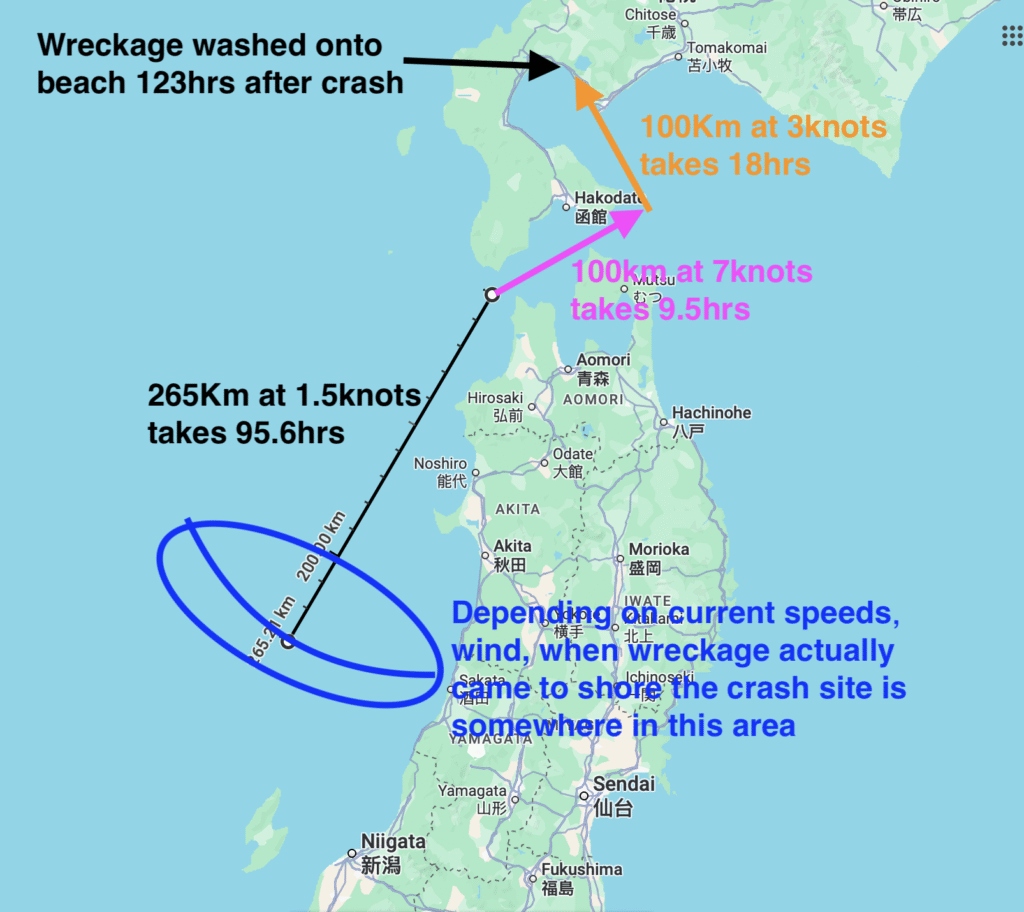
In addition a strong low pressure system (Typhoon Ellen) was present in the area Sept 4-5 with SW winds (same direction as current) of 15-30knots and swell of 2-4m. This would tend to push the crash location further south towards Sado Island.
This piece of debris clearly shows the official crash location to be incorrect. It is also the best data point for determining the actual crash location. All other debris that we know arrival time for were floating for at least another 4 days, compounding any errors.