
From debris dispersal KAL-007 appears to have come down north of Sado Island off the coast of Niigata. Japan has a large array of seismographic equipment and it is possible that a large aircraft such as a 747 would create detectable seismic event. Richard Godfrey calculates the impact of a Boeing 777 crashing at 490knots would generate the equivalent 1.3 tonnes of TNT. This could potentially generate a seismic event of approximately magnitude 2. Typically oilfield seismic surveys use airguns that generate a signal of approximately 2-3Kg of TNT. Triangulation of such data may help pin point the crash location.
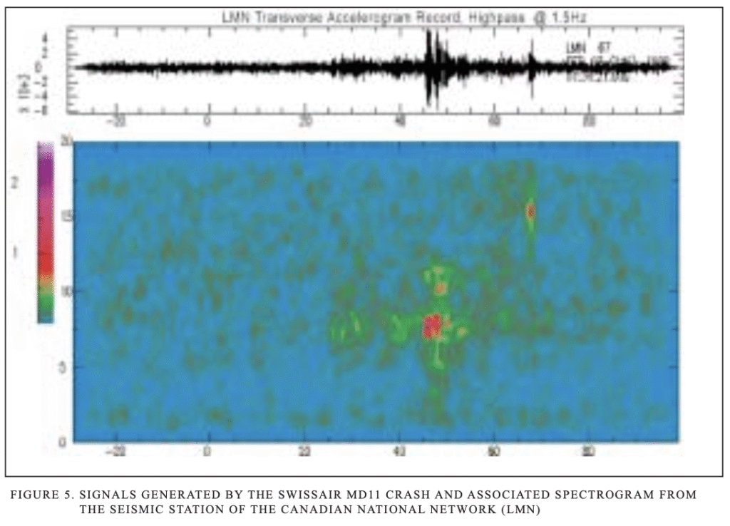
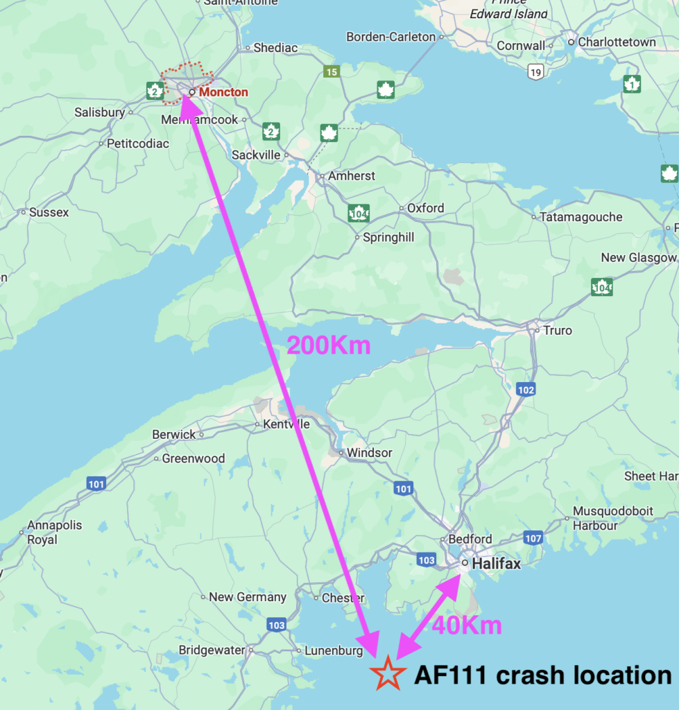
Swissair flight 111 crashed on 2 September 1998. Its crash location and timing was determined using seismographic recorders at Halifax and Moncton which detected a seismic event at the time as shown below. Water depth was 55m.
Debris drift analysis and radio communications from KAL007 have narrowed the search area to an approximate 100km x 100km area centred around 39.8N 138.7E. Water depth in this area is 500-2000m. This means the seismic signature is expected to be much weaker than Swiss air 111.
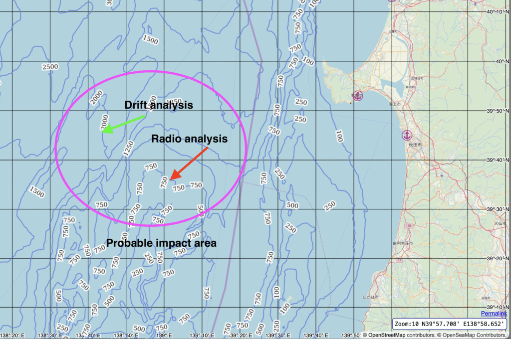
However, studies of seismic surveys (used for hydrocarbon exploration etc) detected by nearby seismic observatories show detectable events in water depths up to 1500m. However the range at which these events can be detected diminishes rapidly with depth. The type of seabed (muddy or rocky etc) also effects magnitude of detectable seismic events.
Thanks to Tohoku university, they have confirmed data is still archived from at least Akita observatory. In December records are planned to be retrieved. (Edit Jan 26: Due to a number of large magnitude earthquakes in the Tohoku region of Japan in early December the staff involved with data retrieval were swamped with other work loads so data retrieval is planned for Jan 2026.
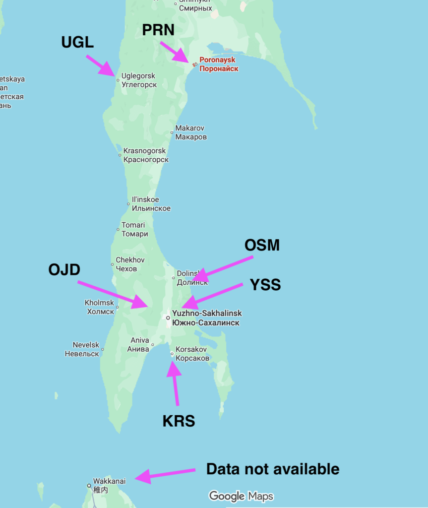
The water depths around Sakhalin are much closer to that of Swissair 111 (100-200m). Consequently seismic signatures are expected to be much larger in this area may give a clearer indication of when and where any aircraft impacts occurred.
Unfortunately the University of Hokkaido has confirmed that data from Wakkanai observatory has not been retained from this era. It possibly may be stored at JMA’s centralised Tokyo department but so far efforts to retrieve that data have not been successful.
However, it appears seismic records may be available from Sakhalin Yuzhno-Sakhalinsk (YSS), Cape Ostryy (OSM), Uglegorsk (UGL) or OJD (Ozhidaevo) observatories, KRS (Korsakov), PRN (Poronaysk).
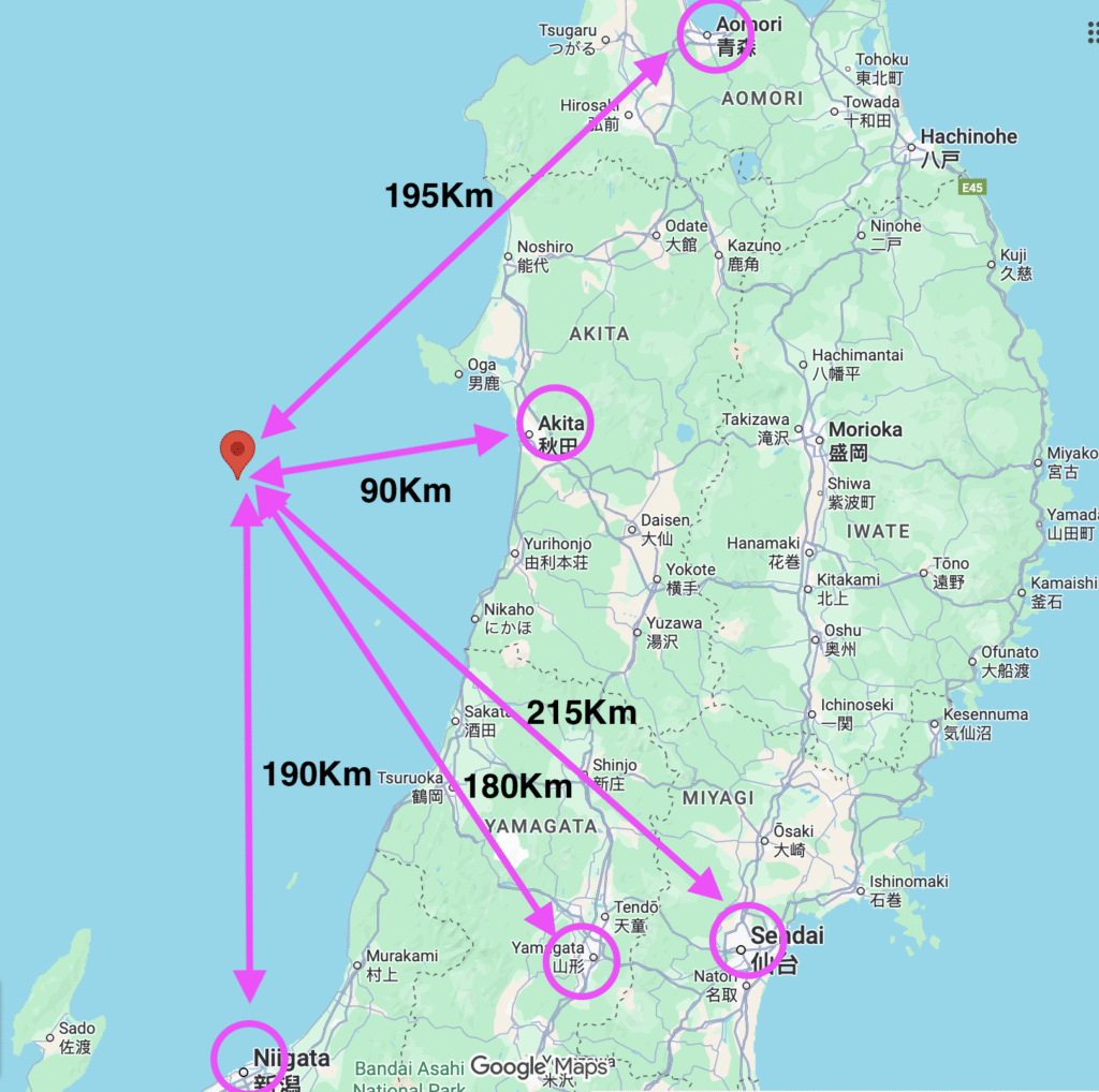
There is no seismic event recorded at https://www.data.jma.go.jp/eqev/data/bulletin/shindo_e.html however on the hypocenter database https://www.data.jma.go.jp/eqev/data/bulletin/hypo_e.html there appeared to be a plausible event matching the exact timing, magnitude of KAL007’s likely crash.
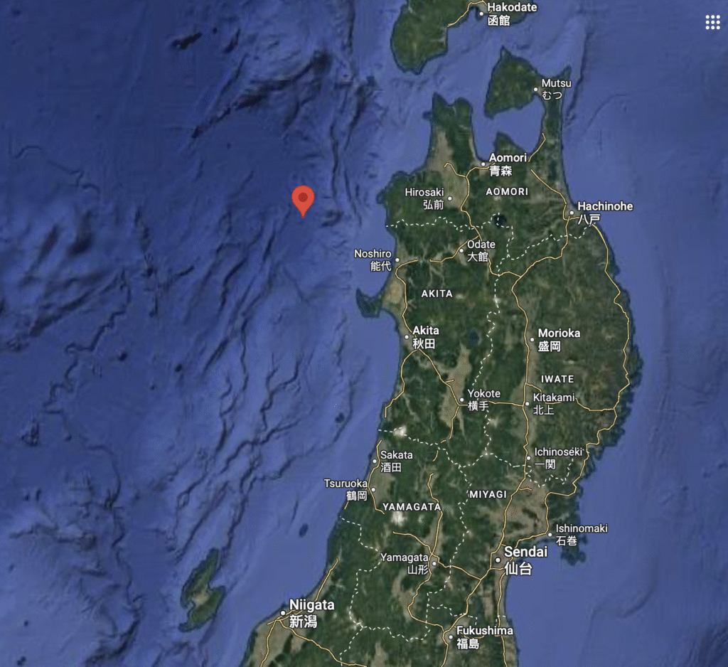
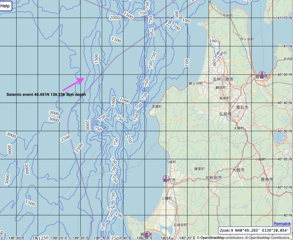
J198308311914466 02 40491 03 139238 09 27 21 33V 111 2 59W OFF AOMORI PREF
i.e. a magnitude 3.3 event at 40.491N 139.238E at a depth of 27km but with 21km depth uncertainty. A large depth uncertainty can imply a close to surface event caused by impact of aircraft. The approximate water depth at this location is 2750m.
The time and magnitude plus the depth uncertainty of this event make it a compelling signal. This is 3 minutes, 26 seconds after KAL007 last confirmed radio call at 19:11:20. It is 1 minute 30 seconds after KAL007’s possible last call. MH17 took between 1 and 1.5 minutes to fall to the ground after being hit by missile so the timing of this seismic event is near perfect. The magnitude is also of approximately the right magnitude for a full velocity impact. The error in latitude and longitude is approximately +/- 1km which makes a search effort much easier.
However, it turns out, unlike other seismic databases, JMA uses local time so this event doesn’t correlate and appears to be aftershock from the major Sea of Japan Earthquake that occurred at May 26, 1983, at 11:59:57.
Since this aftershock is in a similar position and low magnitude to the expected impact zone and also within a few hrs of KAL007’s impact it may be useful to study this aftershock in conjunction with waveforms from the expected time zone.