Early evidence suggests much more than a single intruder event over Sakhalin. Whilst the US government struggled to release any information at all, the Hokkaido Shimbun managed to get and publish radar traces from Wakkanai on Sept 1st in their 2pm edition, less than 8 hrs after incident. The same map was also published the following day in the Ashahi Shimbun.
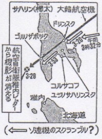
Hokkaido Shimbun radar track and text clearly state the track of KAL007 passing directly over Dolinsk and exiting over Gornozavodsk. The map shows KAL007 disappearing from radar at 3:28 Japan time (UTC 16:28) and Soviet interceptors scrambling much later at 3:53 and also in another area at 3:32. The KAL007 track is dead straight. Why would Soviet interceptors scramble 30 minutes AFTER the single apparent event took place?
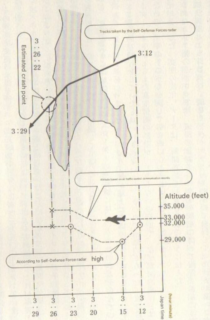
However, 7 hrs later at 9:30pm Sept 1st the Japanese Defence Agency (JDA) published a radar map that is very different.
The JDA radar track is curved and exits above Kholmsk, nearly 50km north of where the newspaper reported the plane exiting Sakhalin. In order to compare the maps, both were georeferenced using mapwarper.net then overlaid. So it appears there were at least two intruders over Sakhalin. JDA later clarified this map was produced “based on radar records processed comprehensively at the Misawa Air Defense Control Center, and does not show the detection status at each radar”
There is still more ambiguity in the JDA map and clearly shows some information is withheld.
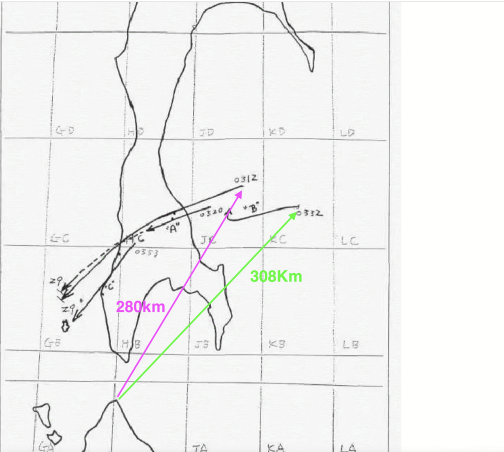
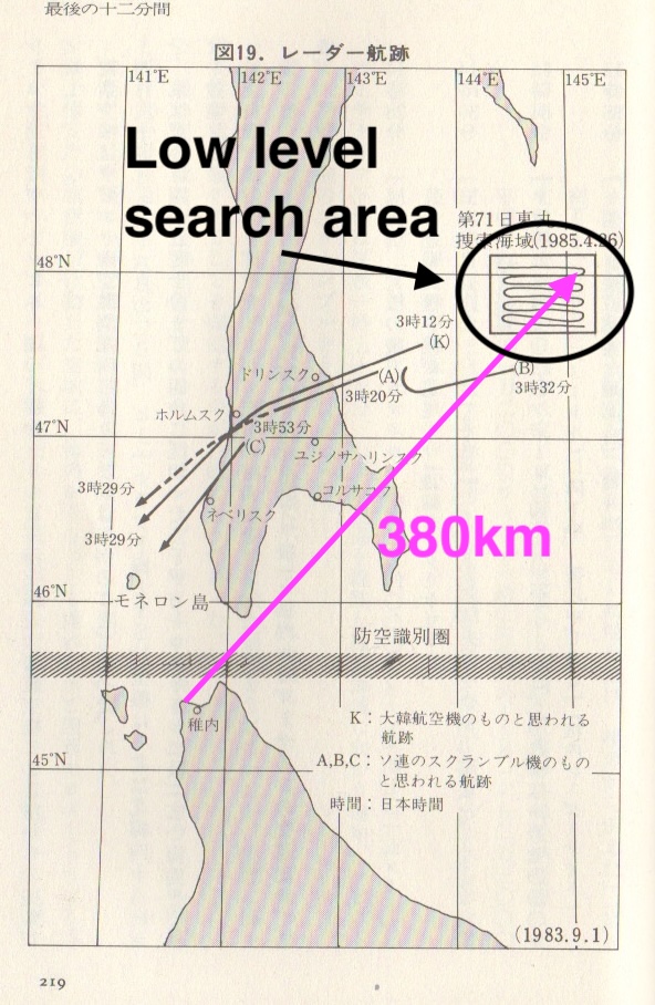
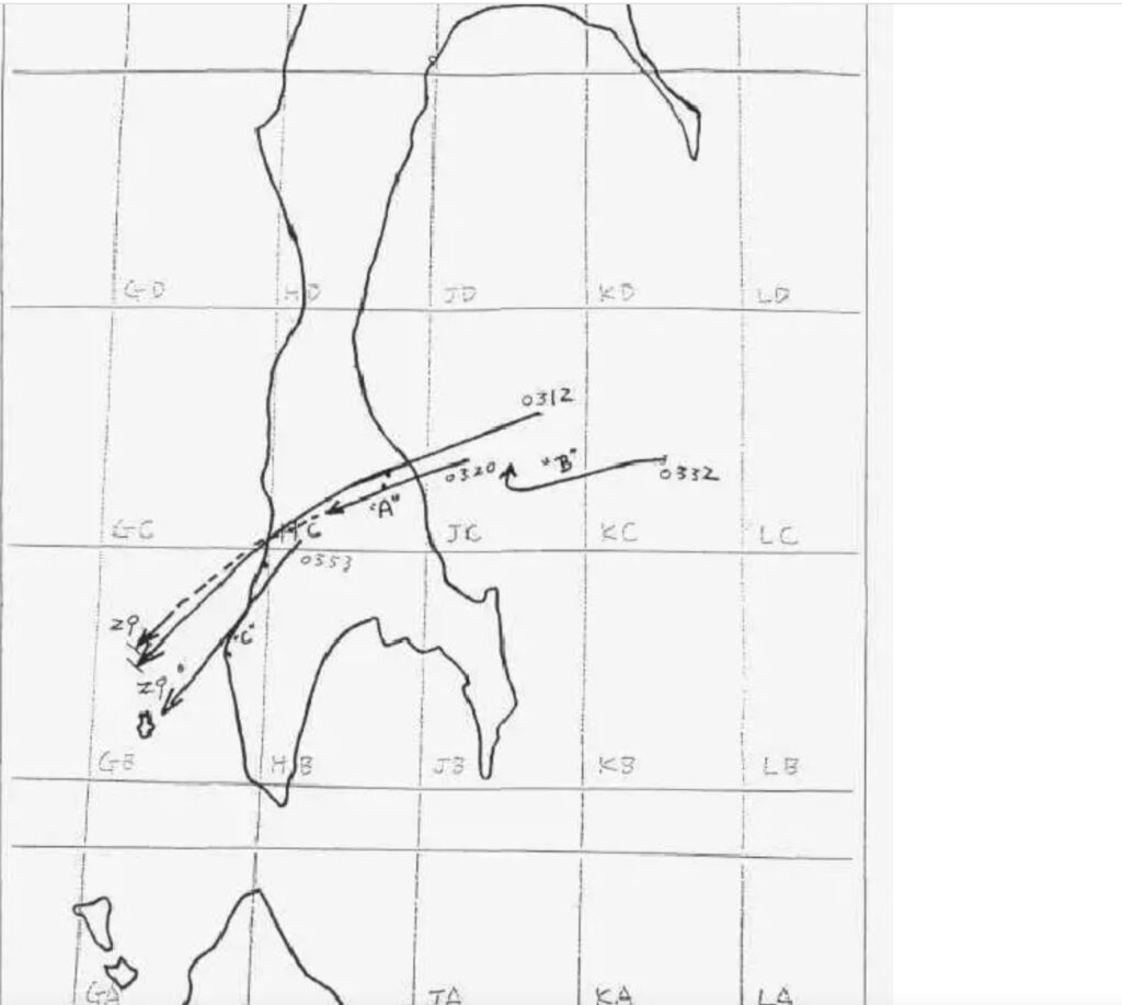
The Soviet interceptor “B” can be seen on radar at a much greater distance than the much larger 747-200. In Iwao Koyama’s book “The Missing Bodies” he shows the Wakkanai radar easily detecting a low level search performed at a much greater distance the following year. David Pearson with his research states that Wakkani radar at the time was a proven 250 miles (402Km) and theoretical 300 miles. It appears the track of KAL007 prior to 3:12 is withheld, possibly because it shows a turn as reported by the Soviets.
The Mainichi Shimbun also published a map Sept 1, 1983. It too shows the radar plot directly flying over Dolinsk then exiting Sakhalin between Kholsk and Gornozavodsk. The trace is also curved unlike that of Hokkaido Shimbun.
The following day the Yomuri Shimbun published the following map. It can clearly be seen the radar trace enters Sakhalin well south of Dolinsk. The radar trace is dead straight. Also note the time of missile strike 3:25 and loss of radar at 3:29 (Japan time). Very different to both Russian missile strike at 3:24 over Pravda and US times (3:26, 3:38)
The Hokkaido Shimbun published another 2 maps on Sept 2. The missile strike has now changed to 3:25 to 3:36 and the radar trace exits well south of Kholmsk. The time of 3:29 still shows as loss of radar.
On Sept 3 the Ashai Shimbun published a map which also had the times listed as 3:29 as disappearing from radar and 3:38 mentioned for the first time matching the US timing of crash. If the map is accurate then the plane travelled around 20km between loss of radar to impact.
Right from the start the Japanese were keenly aware the the current flows always north and that debris from the crash should drift north as first published in the Hokkaido Shimbun on Sept 3.
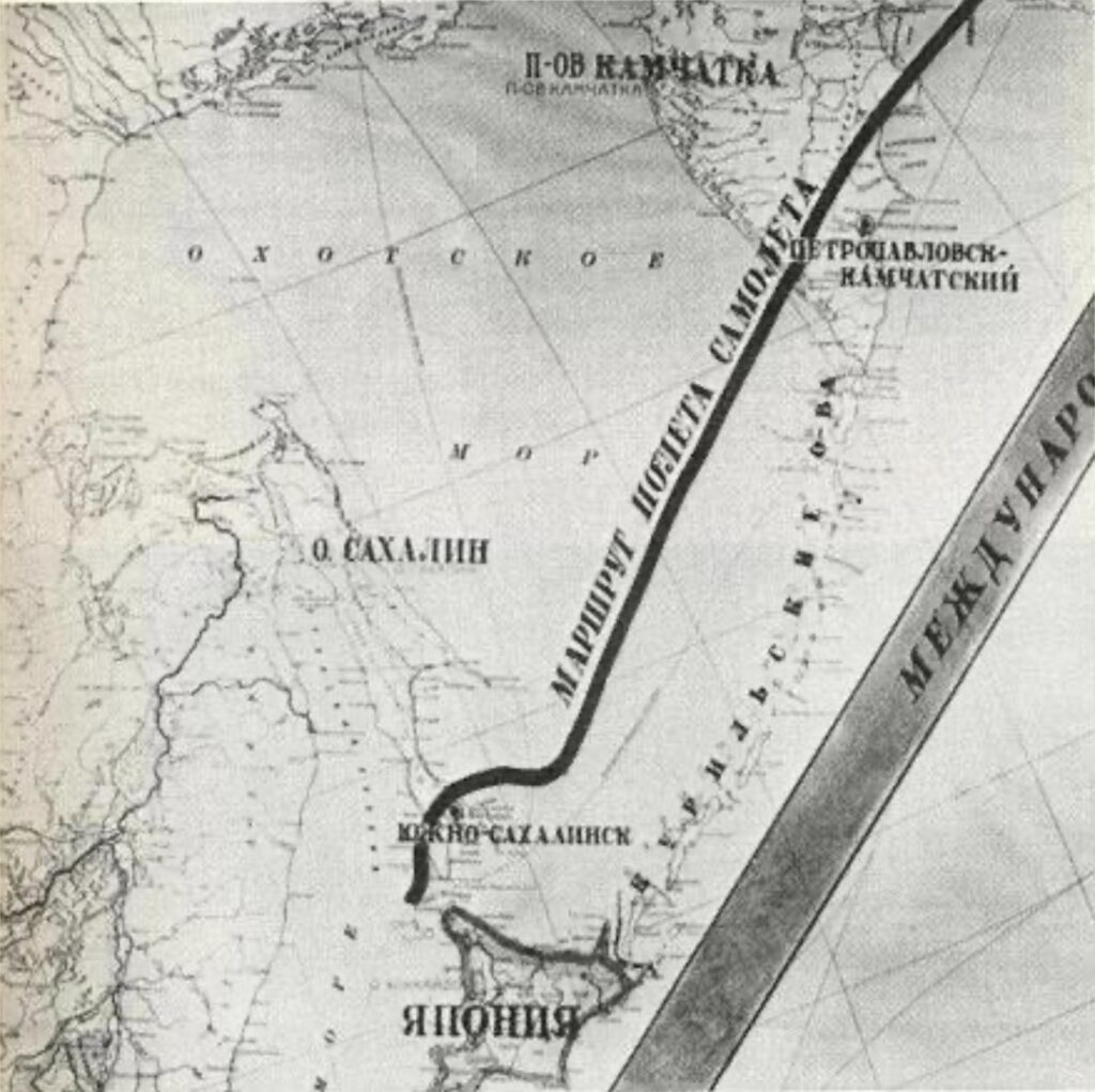
It is interesting to note that from the very start the Russians clearly stated that KAL007 violated their airspace but then headed south the the of Japan where they traced it on radar for 10 minutes before it disappeared. The first map from the Soviets was released in the Yomuri Shimbun on Sept 4. Nikolai Orgakov used it again on Sept 9, 1983. It clearly shows the trace of what they claim was KAL007 flying well south of Moneron island and almost to Japan.
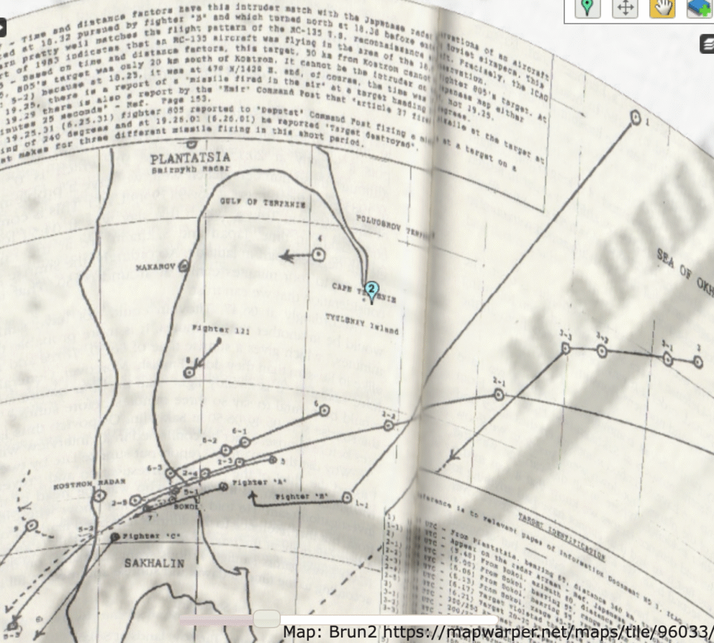
Overlaying Orgakov’s map with other maps is enlightening. This is a map from Michel Brun’s book overlaid with Orgakov. It can be seen that the Soviets may have misinterpreted multiple aircraft for a single one. Not proven at this stage but Brun claims a large scale air battle over Sakhalin explains why the variety of radar traces and times.
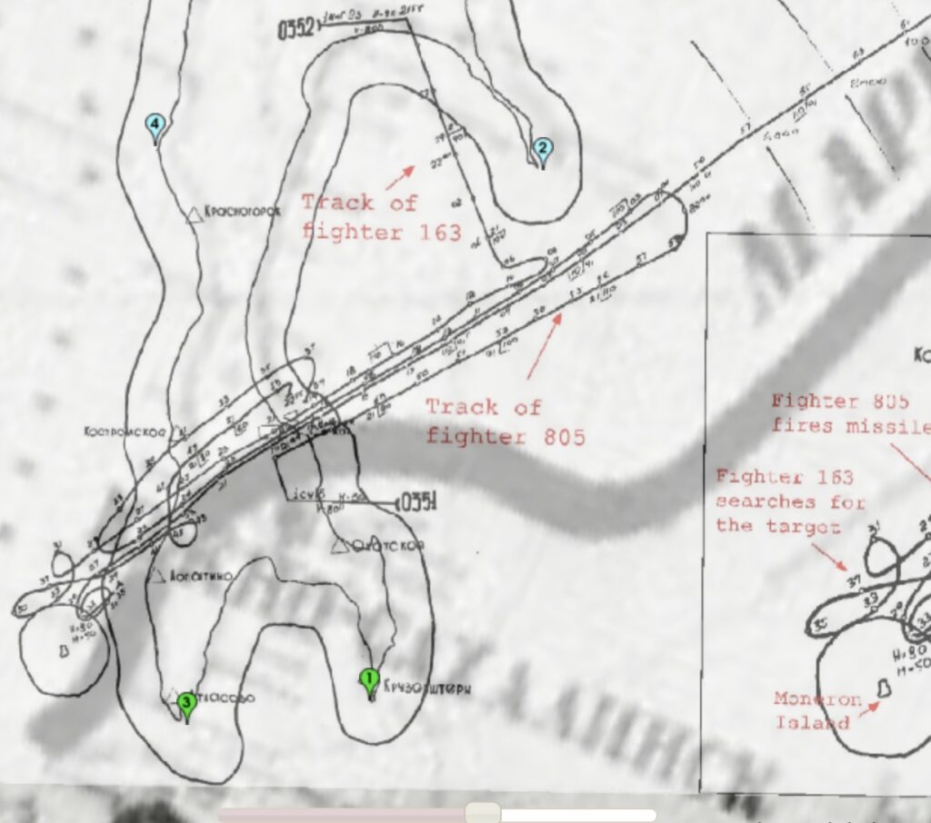
The Soviets also released detail radar map including times in the 1993 Icao report. Overlaying this with the original JNA map formally released shows distinct different tracks. The Soviets show the radar track of the target they say they shot down (not KAL007) having a dead straight trajectory versus the JNA plot showing a curved trajectory.
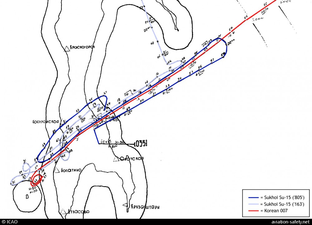
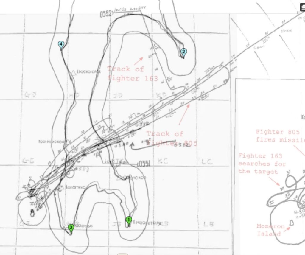
Comparing the original Soviet map they state was KAL007 with the radar trace of what they claim was the intruder they DID shot down clearly show the Soviets were well aware at least two different aircraft were involved and each flew very different paths.
Much later (1985) the Japanese Diet forced the release of more radar data. This graphic (from Iowa’s Koyama book) clearly shows a plane changed direction and altitude multiple times prior to missile strike as per the Soviet claims. There is no suggestion this was KAL007